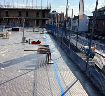
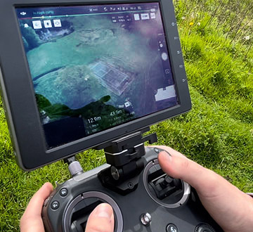
Setting Out / Surveying
MJ Fuller solutions have been offering civil engineering & surveying
services since 2012.
From first time developers to those construcing 1000+ properties.
Our comprehensive land surveys are used for small planning
applications to sizeable landfill volume calculations.
Our experience enables us to provide tailored and professional
services to our clients specific requirements.
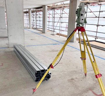
Setting Out
Our setting out services cover many different aspects of construction. From residential developments to RC Frames and infrastructure.
This would typically include but not limited to the following:
- Temporary bench marks and site datums
- Foundations for excavation. (Strip foundations, rafts and ground beams)
- RC Frames
- Steel Structures
- Piling mats and piles
- Brickwork and levels
- Roads (Profiles for capping / sub base construction and kerb line)
- Drainage Services
- Soft landscaping and swales
- Providing drawings and as-built data to be sent to technical departments if required.
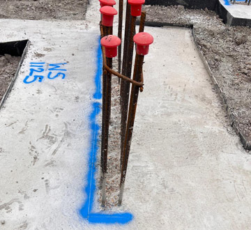
Site Surveys
Our site surveys can be carried out for a number of reasons and can be presented in several formats as required. Commonly this is in an easy to read PDF format but can be issued as AutoCAD drawings if required. Some reasons for these surveys are as listed below:
- As-built quality checks
- Ongoing site progress
- Drainage line and level
- Service positions
- Stockpiles on-site for volume analysis
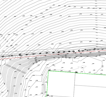
Topographic Surveys
We offer a range of topographical surveys dependant on the application. However these are most commonly used in planning applications. All surveys are professionally drawn and provided in an easy to read PDF format. This can be tailored to your requirements but often include the below:
- Existing services
- Current site levels
- Site features (trees, fencing, structures parking areas etc)
- Site boundaries
- Surrounding dwellings and levels
Boundary Surveys
Usually used as part of a land dispute we create a tailored survey showing the position of the required buildings and or fences etc. Professionally drawn and with the information delivered in an easy to read format so this can be compared for legal purposes.
Land Surveys
We create a professional easy to read drawing for our comprehensive land surveys which are often used for agricultural purposes. These can be surveyed via traditional methods or if the speed of completion is critical or the survey is covering a large area this can be completed as a drone survey without sacrificing detail of any features.
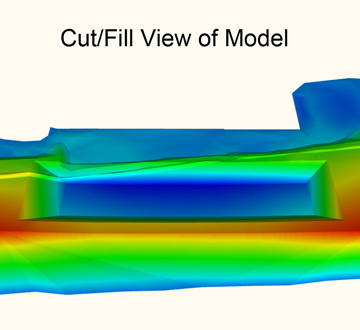
Earthworks / 3D Modelling
We can carry out any required surveys and create a design proposal to your requirements. On completion a professional easy to read drawing with your proposal is issued ready for submission to planning.
Machine Control / 3D Modelling
We offer a complete service arranging for the installation of the machine control, generating a working model from the site drawings and if required we can upload this to the machine for you. These models can be tailored to suit the application with offsets etc. as necessary. The machine driver follows the screen in the cab which updates in real time enabling them to shape / cut and fill the required area to the proposed design with no down time when conventional setting out may be lost. We do this for many different applications for both infrastructure and residential developments and is usually used for bulk work for example road construction, piling mats, earthworks (swales or bulk cut and fill exercises etc.). We are seeing this technology being used more and more often and we are with increasing frequency now creating models for other uses like excavating foundations.